Written by community archaeologist Alexis Haslam.
As part of this year’s Totally Thames Festival we will be undertaking a couple of walks along the Thames foreshore just in front of Fulham Palace. Always an interesting outing we usually discover something noteworthy and it is always exciting to see the Saxon fish trap previously revealed and recorded by the Thames Discovery Programme. I am often asked however about the Palace’s relationship to the foreshore and how it developed over time.
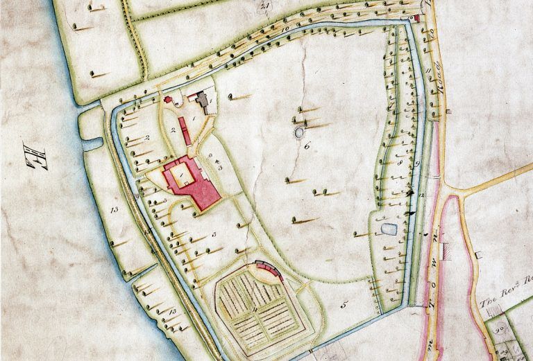
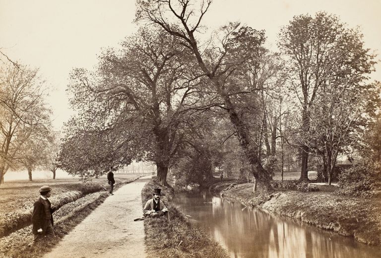
The main thing to remember is that Bishops Park and the riverside embankment are actually relatively recent. The land extending from the Palace down to the Thames did of course belong to the Bishop of London and with no protection from estuarine incursions, flooding had often proved problematic. There has been some form of public access along the riverside frontage from as early as 1720, with the footpath which runs alongside the Palace referred to as ‘Bishop’s Walk’ or the ‘Lord’s Walk’. In 1775 during the tenure of Bishop Terrick the walk had to be raised due to consistent flooding from the Thames. This may have been the point at which an additional ditch was introduced to the south side of the footpath. The ditch is not present on Rocque’s map of 1745, but is clear on the Estate map of 1831. In 1808 Bishop Porteus referred to this ditch as an ‘embankment’ introduced to protect the house and grounds from the flooding from the Thames.

By the late 18th century the Bishop’s Walk was therefore rather an odd thoroughfare, with the moat on one side and a ditch, presumably often filled with water at high tide, on the other. When flooded it must have been impossible to pass. It was the Bishop’s duty to repair and maintain the path and Porteus used to enjoy watching the local population using it to attend All Saints Church in their Sunday best.
The embankment was not particularly effective however and a substantial flood was recorded on the 16th of November 1842. The stretch of land along the riverside which had once been used as grazing land by the Bishop’s cattle was rapidly becoming an eyesore and by the late 19th century urban expansion had led to Fulham becoming less of a rural idyll. In fact the former meadow was being used as the local rubbish tip. So, on the 14th July 1883 Bishop Jackson offered the stretch of land which extended from the south side of the moat down to the Thames along with the associated footpath to the Fulham Board of works. This was on condition that the land would be used as a public park.
This was accepted and dumping on the foreshore was banned in 1887 as initial embanking began. Further land was offered in 1891 in the form of the West Meadow, the area now occupied by the tennis Courts on Bishops Avenue and the Palace Gardener. With a further grant of £5,000 from the London County Council the park began to be laid out and the concrete embankment was constructed by Joseph Mears in 1893 at a cost of £12,617 15s 10d. Interestingly, given the embankment’s proximity to Craven Cottage, Joseph Mears’ sons Joseph and Gus would go on to found Chelsea FC in 1905 some 26 years after Fulham F.C. was established.
The creation of the embankment did of course mean that alterations had to be made to the Palace’s sluice system and when you visit the foreshore today you can still see the chamber within the embankment wall that was used to fill and drain the moat. The Park largely opened on the 22nd December 1893, but further additions were made with Fielder’s Meadow (the stretch between the Palace and Craven Cottage) handed over in 1894 and opened to the public in 1903. The Moat Gardens were added to the Park in 1924 after the infilling of the moat and were subsequently and expanded in 1926.
Bishops Park has therefore been a popular spot for public visitation for well over 100 years and in handing it over the Bishop was certainly saving himself a fair bit of outlay in regards of maintenance and cleaning. I often wonder what it would have looked like before the embankment was built though and how high the tide would have risen along the river frontage.